

|
|
Things have been really active in N. Ireland since the beginning of August. During July I was really having serious doubts about the thunderstorm season this year, however everything has changed, quite dramatically, since August 1st. This was my eighth day of local storms in Maghera since the Spring, which is quite active for this country. It has actually been better than the great 2007 season, had this been two months ago I never would have believed it. This really has been a wild Summer for N. Ireland and according to some sources it has been the wettest in one hundred years. Of course the majority of people are complaining about it but for me it's just what I was waiting for. On the first day of September a deep low pressure system was located to the W of Ireland over the Atlantic Ocean, and as it traveled eastward it would send a series of big convective showers across land during prime heating hours. The models gave a CAPE value of nearly 600 and a lifted index (LI) of - 2 which looked good to me. There was some vertical wind shear but not a great deal. The main threat was gusts of wind, heavy showers, and thunderstorms. I did have a very good feeling about this day so I made sure to check the online data from 09.00 onwards.
During the early morning the Sun was hot and already some weak convection had got going but I wasn't impressed with the cumulus. It reminded me of the poor stuff seen in mid Winter with soft tops and no bases to speak of. By 10.00 the air mass had changed due to increased solar heating and now the convection was getting impressive and more wide spread. The cu looked excellent so I did another check on the radar before I decided what to do next. The returns showed big showers now inland on the SW and W Irish coast with yellow radar echoes so they were strong enough already. They began drifting in my direction and seemed to become more organized with time, the sferics charts showed some lightning on the coast so I decided it was time to hit the road.
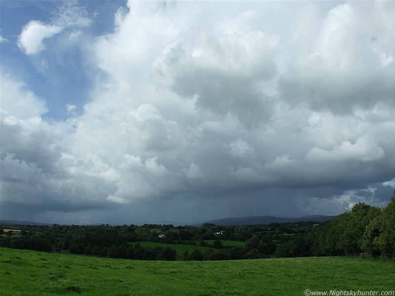 |
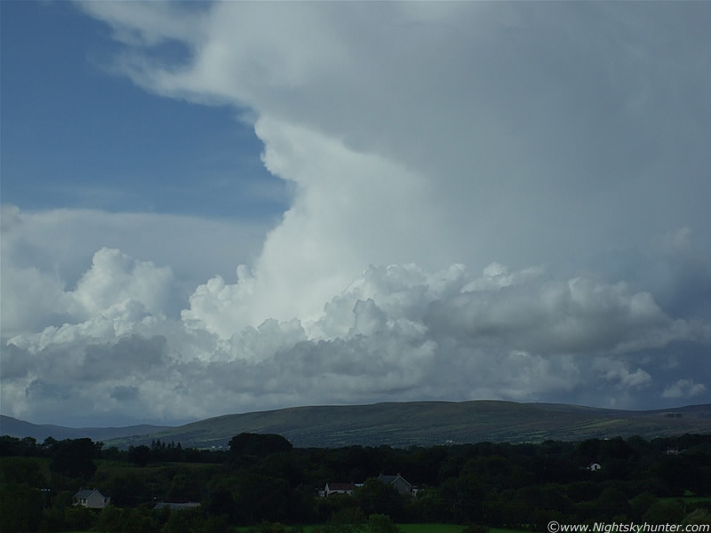
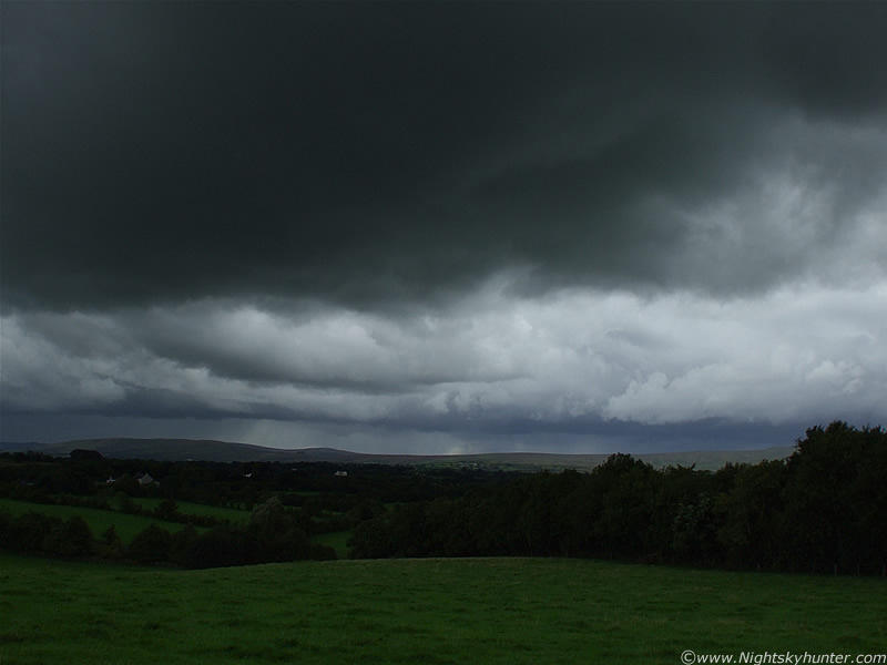
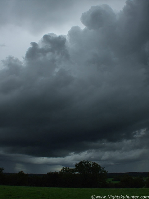
By 11.30 I was set up at my favourite location on high ground overlooking the town and surrounding mountains. This is such a beautiful and peaceful place. I absolutely love doing storm photography from here. Not only do I have a great view but I'm surrounded by nature. Lots of Cows, Sheep, Rabbits, and majestic Buzzards doing their thing while I sat on a warm rock watching the convection while the Sun burned me. I didn't have long to wait before those cells on the radar arrived in from the SW over the Sperrin mountains. The convection was quite slow moving today so I had plenty of time to watch everything organize. This is looking W as the growing storms slowly headed in my direction. They first appeared as towers over the hills but as they crept closer and closer they seemed to explode with energy as they grew into tall towering cu with rock solid updraught plumes then began to glaciate as they matured into cbs, which produced a light shower, then intensified until the precip curtain became better defined and more intense. This line extends SW to N. You can see the intensity of the showers.
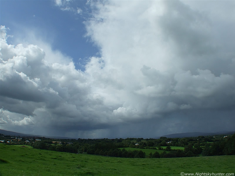 |
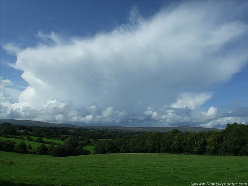
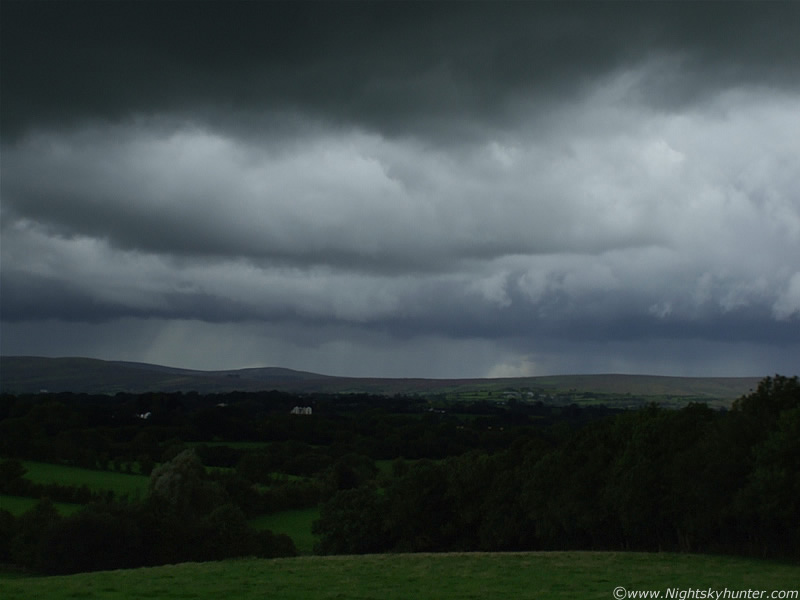
Moving closer now. The image really doesn't convey how large these cbs were. This was taken with a super wide angle lens and yet the line extends out of frame to the R (N). I took a vertical shot to show the true height of the anvil but it wouldn't even fit in that!. So in short, these are MUCH bigger than they seem on the images. The first of many rumbles of thunder could be heard at this time. I didn't notice the lightning at the time but the rumbles seemed to be from the L (S) side of the line. That would be to the W of the town of Maghera or looking S if you where driving down the Glen Shane Pass.
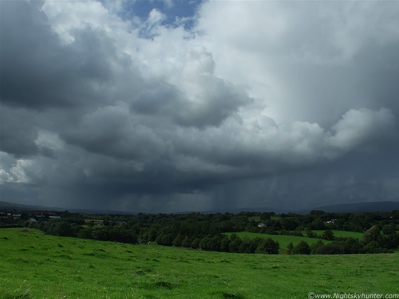 |
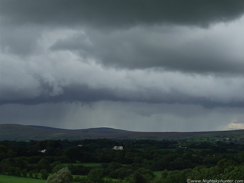
Closer. More thunder. It may not look it but that rain was actually quite intense when it hit me. I took cover out of frame to the R as the storm passed over my head into the E producing more lightning flashes and long rumbling thunder. I very much enjoyed that, a storm already, and there was more to come. The view behind the storm was spectacular with frightening looking towers and mammatus. After getting a good downpour a clearance arrived and the Sun was back out. Convective cells seemed to shoot up everywhere after this. In the NE was a monster with an overshooting top but it was too far away for a decent image. Probably a pulse storm active in that direction.
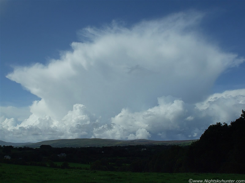 |
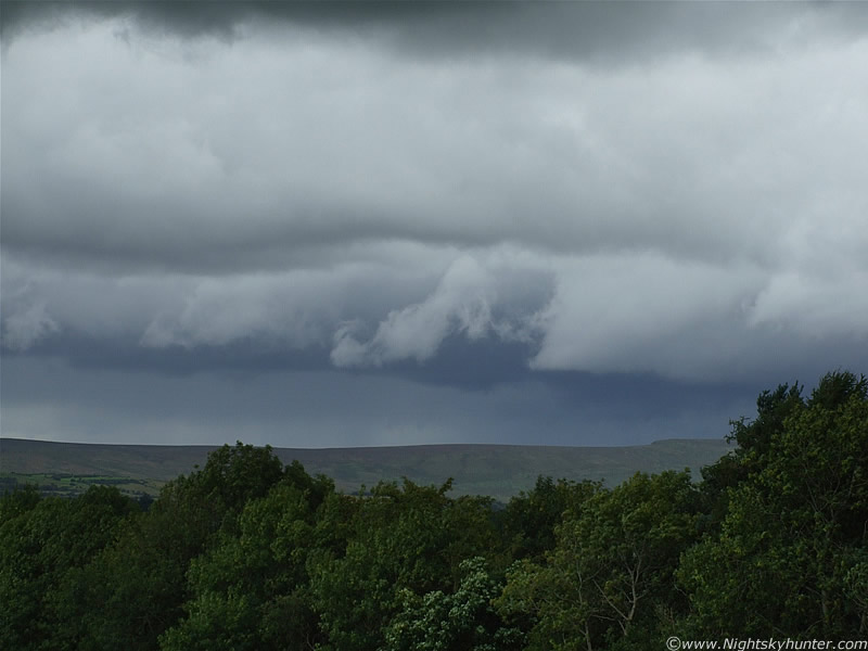
Soon this monster cb popped up over the mountains. This was HUGE, considering the incredible amount of miles away this was you can sense the size. The anvil was a beauty and had a hint of back shearing for a time. No doubt this probably was a storm further W when it arrived over the coast. The mammatus forming on the anvil are a sign that the cell was weakening now. It's moving L to R here. The line of cu towers at the side all merged together and formed another organized thunderstorm which really let loose in the N sky. I would love to have seen the base of this beauty, who knows what could have been hanging from it.
 |
This is the flanking line of cu towers on the L (S) side of the cell. Each one of these guys was huge and bubbled up at incredible speed and replaced the primary updraught of the cell. This multicell was too far away to hear thunder but I'm sure it was bad over on the other side of the mountains.
 |
W to NW skyline. Mammatus forming at the centre of the anvil. Another cb can be seen to the lower R behind the big one. This was such a beautiful sight with the naked eye. I just stood there watching it for a long time interrupted periodically by rumbles of thunder from the old storm to the E (behind me). The fun times with bright white convection against a blue sky changed a little later when more serious action kicked off a lot closer to me.
 |
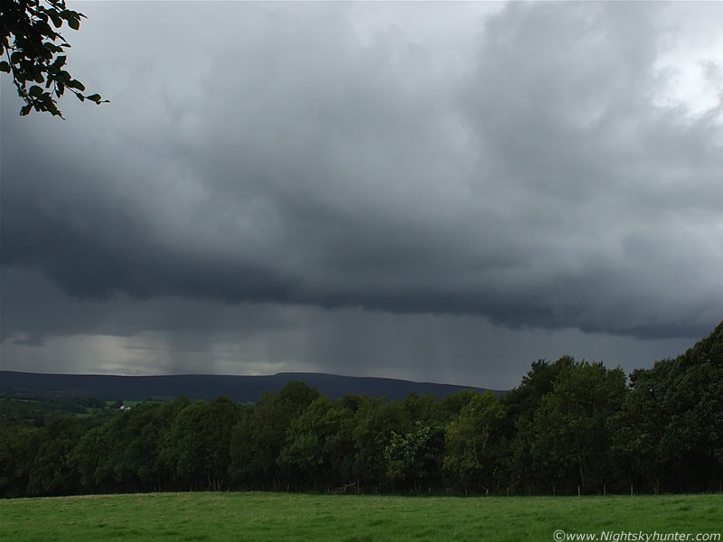
This image takes in the SW to S sky showing a nasty storm moving from R to L. Actually looking back on it I think this was two big storms. The big precip area to the L is the rear of the first one and the sweeping clouds to the lower R was the second. The dark cloud base to the upper R was another nasty cell with very strong inflow. Scud fragments rose upward into the base at high speed. I could feel a strange unnerving sensation on the top of my head when it passed over which was very alarming. The distant storms here were nasty!. At first there was a distant rumble, a few min's later another, then a long period of silence which was broken by spine tingling loud booms of thunder which seemed to echo across the entire sky. It was frightening to say the least. Bright white flashes appeared from the distant storm to the R but the precip area to the L was the dangerous one. Here, bright blue c-g bolts with wicked looking branches hit the ground near Slieve Gallion, and higher up within the rain curtain nasty intra-cloud bolts of similar form popped out from the grey and shot upward into the sky.
 |
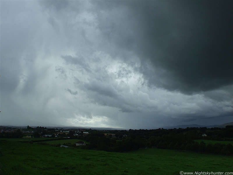
This is how dark the sky was during the afternoon. Go back to the above image and look at the distant storm to the lower R. This is that storm now moved into the S and closer. Fantastic c-gs hit down within the precip area to the R of centre. Storm moving R to L. The previous storm was blowing heavy rain on me here so I took this capture under very difficult conditions out in the open close to the lightning prone area.
 |
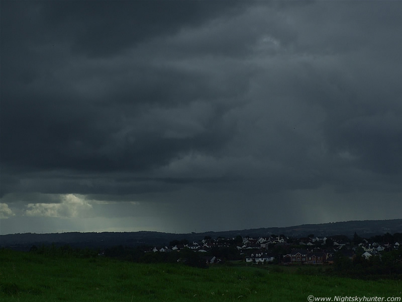
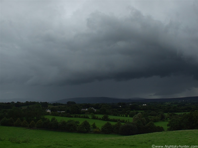
Base of retreating dark cell above and in the distance was a very impressive sight. This was a giant Shelf Cloud forming and marking the leading edge of another big storm. This is looking NW. The entire Shelf extended from SW to N. As it moved towards me I could see lightning flashes from under the precip curtain behind it followed by very distant rumbles of thunder which gave the impression of a big animal with a bad temper getting angrier by the min.
 |
Shelf getting closer. Nice double stack profile.
 |
Loud thunder now!. Blue c-gs stabbing down through the precip curtain like daggers. This was fantastic to watch as it came closer.
 |
Camera turned further to the R (N). Visualize this image attached to the R of the above image for a sense of size, and that is still only half the Shelf's true length.
 |
Looking N at a very dark flanking line of towers. Those reached the zenith. You can see the R (N) section of the Shelf Cloud in the distance. Moving L to R.
 |
Turning the camera around 180 degrees to the L so I can catch the L (S) end of the Shelf/storm. Nice twisted structure to the R.
 |
Panning to the R into the NW section as it got closer. Full blown storm underway now as I took these images. Regular loud rumbles and even 'cracks' of thunder really going for it with regular lightning. This was quite close to me. Storm moving to the R and towards me. I came so close to catching my very first 'still image' of a daylight bolt. Just about a fraction of a second after I took this image a stunning blue c-g dropped from the far R of the Shelf within the precip area and hit down below that tall tree. It was a beauty with big curved branches. I cursed myself, I was so close, it would have been an excellent image. I could actually see it on the LCD screen. The rumble of thunder in this area on the video was taken straight after that c-g, so you know the background to that. After I took the video clip another shot out from the exact same area, this time an I-C bolt which curved upward over the rim of the Shelf. This was fantastic!. More on page two.
Martin McKenna